Category:Maps: Difference between revisions
Jump to navigation
Jump to search
>Sitb m (Reverted edits by PrlcklyWasTaken (talk) to last version by Sitb) |
>Sitb No edit summary |
||
| Line 1: | Line 1: | ||
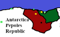
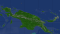
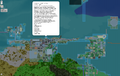
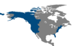
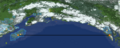
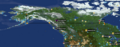
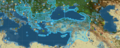
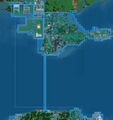
Below is a list of '''maps''' depicting various regions of EarthMC. This category includes map images, as well as articles that are specifically dedicated to one or more maps. | Below is a list of '''maps''' depicting various regions of EarthMC. This category includes map images, as well as articles that are specifically dedicated to one or more maps. | ||
[[Category:Images]] | |||
Latest revision as of 13:24, 26 July 2020
Below is a list of maps depicting various regions of EarthMC. This category includes map images, as well as articles that are specifically dedicated to one or more maps.
Pages in category "Maps"
The following 3 pages are in this category, out of 3 total.
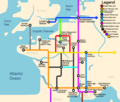
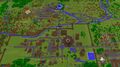
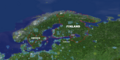
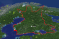
Media in category "Maps"
The following 200 files are in this category, out of 622 total.
(previous page) (next page)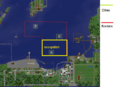 NPSterritorry2.png 678 × 491; 185 KB
 Nt chile.png 1,278 × 870; 759 KB
 NubiaControl26Nov.png 1,074 × 877; 1.69 MB
 NubiaYemen.png 1,249 × 740; 1.64 MB
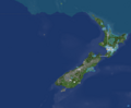 Nz lol.png 1,010 × 835; 292 KB
 NZ Territory.png 1,122 × 772; 69 KB
 Oban wiki.png 1,390 × 767; 1.25 MB
 Official map.png 500 × 487; 63 KB
 Ok-0.png 444 × 254; 17 KB
 Old Hankou.png 600 × 696; 117 KB
 Omitama.png 754 × 548; 82 KB
 Ooga.png 1,338 × 463; 384 KB
 Outline.JPG 746 × 825; 80 KB
 Overheadramreemap.png 519 × 573; 275 KB
 Owari Map 2020.1.10.png 1,086 × 860; 449 KB
 Pankokosik.png 270 × 165; 6 KB
 Papua.png 822 × 460; 211 KB
 Patapolis.png 1,527 × 967; 575 KB
 Peak cascadia.png 1,670 × 936; 48 KB
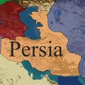 Persia Claim Map.jpg 459 × 459; 88 KB
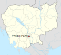 PhnomPenh.png 224 × 203; 30 KB
 Plan agrandissment residentiel nuit.jpg 1,920 × 1,570; 2.32 MB
 Plan agrandissment residentiel.jpg 1,920 × 1,570; 3.94 MB
 Plan residentiel Est delimited .jpg 1,550 × 1,322; 2.26 MB
 Plan.cathedrale.Mans.png 1,529 × 836; 376 KB
 Pol india map.png 684 × 719; 413 KB
 Polish map 02.06.2019.png 1,000 × 481; 469 KB
 PolishKingdomMap.png 2,753 × 1,400; 63 KB
 PolishMap.png 1,920 × 1,080; 3.06 MB
 PolishTerritory2018.png 1,440 × 581; 1.23 MB
 Political Map of China.jpg 3,520 × 2,970; 1.66 MB
 Political Map of Northern Europe.png 1,280 × 984; 1.87 MB
 Poop.png 363 × 384; 84 KB
 Portugal-page-001-0.jpg 1,495 × 1,058; 67 KB
 Portugal-page-001.jpg 1,495 × 1,058; 65 KB
 Posio.jpg 1,444 × 817; 276 KB
 Pourfanos.png 555 × 413; 294 KB
 PrefectureGRE.png 400 × 154; 136 KB
- Present from Franz 2019-07-28 04.05.23Present from Franz 2019-07-28 04.05.23 File missing
 Prilep Overview.png 773 × 515; 133 KB
 Pripyat - Districts .png 1,575 × 806; 1.3 MB
 Project AlfredPhase One.png 818 × 818; 153 KB
 Projeto são sebastião1.jpg 1,692 × 1,032; 915 KB
 Province Map 8 30.PNG 596 × 408; 125 KB
 Provinces.PNG 699 × 405; 573 KB
 Qing political map.jpg 1,761 × 1,795; 3.04 MB
 Qing Territory.png 3,930 × 2,048; 347 KB
 Raktown WAR.png 288 × 357; 60 KB
 RebelScot1.png 430 × 405; 216 KB
 Regions-0.png 965 × 676; 101 KB
- Error creating thumbnail: File with dimensions greater than 12.5 MPRegions.png 6,930 × 5,291; 1.87 MB
 Riau1-0.PNG 562 × 596; 31 KB
 Riau1.PNG 133 × 149; 11 KB
 Riau2-0.PNG 1,381 × 1,010; 493 KB
 Riau2.PNG 691 × 505; 390 KB
 RoadSystem.png 653 × 464; 642 KB
 Roanapur 2.PNG 682 × 697; 334 KB
 Roanapur 3.PNG 678 × 669; 309 KB
 Roanapur 4.PNG 639 × 667; 295 KB
 Roop land territory.jpg 1,148 × 968; 197 KB
 Rostock-0.png 1,225 × 670; 716 KB
 Rup.jpg 2,040 × 1,320; 276 KB
 Rupe land.jpg 2,040 × 1,320; 435 KB
 Rupert.png 2,099 × 1,845; 455 KB
 Ruperts Land Territory.jpg 2,040 × 1,320; 443 KB
 SA.png 570 × 473; 51 KB
 Safe Trading Location.jpg 451 × 377; 47 KB
 Sarawak.png 615 × 643; 267 KB
 Sasd.png 690 × 798; 272 KB
 Satan.JPG 482 × 497; 54 KB
 SAU.jpg 900 × 1,220; 71 KB
 Saudiarabiamap.png 670 × 455; 433 KB
 Scotlandmap - Copy.JPG 983 × 876; 317 KB
 Screen Shot 2019-03-07 at 6.13.54 pm.png 226 × 187; 74 KB
 Screen Shot 2019-04-08 at 7.38.40 PM.png 901 × 625; 1,000 KB
 Screen Shot 2019-04-18 at 8.19.21 PM.png 873 × 571; 522 KB
 Screen Shot 2019-04-22 at 12.00.32 PM.png 475 × 428; 166 KB
 Screen Shot 2019-06-16 at 11.06.55 AM.png 1,337 × 904; 1.32 MB
 Screen Shot 2019-08-22 at 15.02.52.png 425 × 335; 119 KB
 Screen Shot 2019-12-11 at 15.03.32.png 425 × 613; 272 KB
 Screen Shot 2021-01-14 at 11.22.37 AM.png 368 × 410; 310 KB
 Screenshot (258).png 866 × 723; 532 KB
 Screenshot (268).png 691 × 752; 118 KB
 Screenshot (3).png 284 × 391; 126 KB
 Screenshot (4).png 1,638 × 962; 288 KB
 Screenshot (46).png 427 × 523; 256 KB
 Screenshot (59) LI.jpg 1,758 × 944; 288 KB
 Screenshot (61).png 1,360 × 768; 1.27 MB
 Screenshot (62).png 1,360 × 768; 891 KB
 Screenshot (63).png 1,360 × 768; 82 KB
 Screenshot (64).png 740 × 566; 303 KB
 Screenshot (66).png 1,360 × 768; 226 KB
 Screenshot (67).png 1,360 × 768; 850 KB
 Screenshot (68).png 1,360 × 768; 703 KB
 Screenshot (70).png 1,360 × 768; 184 KB
 Screenshot (71).png 1,360 × 768; 272 KB
 Screenshot (74).png 1,360 × 768; 734 KB
 Screenshot (99).png 677 × 677; 96 KB
 Screenshot 1-0.png 348 × 311; 49 KB
 Screenshot 1.png 565 × 411; 166 KB
 Screenshot 2018-10-26 at 8.56.23 PM.png 335 × 403; 127 KB
 Screenshot 2018-11-15 at 9.58.38 AM.png 824 × 449; 64 KB
 Screenshot 2018-11-15 at 9.jpg 824 × 449; 228 KB
 Screenshot 20191111 112321 com.android.chrome.jpg 1,080 × 2,244; 398 KB
 Screenshot 20191111 191458.png 991 × 629; 308 KB
 Screenshot 20191115 142028 com.android.chrome.jpg 1,080 × 2,244; 363 KB
 Screenshot 283.png 871 × 481; 168 KB
 Screenshot 39.png 840 × 626; 382 KB
 Screenshot 52.png 902 × 680; 358 KB
 Screenshot 6-0.png 347 × 215; 23 KB
 Screenshot 6.png 487 × 326; 86 KB
 Screenshot 7.png 359 × 260; 25 KB
 Screenshot90.png 504 × 389; 63 KB
 SecondNubianEmpire.png 1,249 × 740; 1.74 MB
 SecondNubianEmpire2.png 1,249 × 740; 1.68 MB
 Sesgcp1-0.png 660 × 462; 352 KB
 Sesgcp1.png 660 × 462; 352 KB
 Shiga early.png 1,920 × 1,017; 4.6 MB
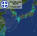 Shimazu Map October2.png 1,554 × 1,498; 1.19 MB
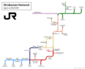 Shinkansen Network 2020.1.10.png 2,070 × 1,698; 217 KB
- Error creating thumbnail: File with dimensions greater than 12.5 MPSiam-0.png 4,558 × 4,233; 726 KB
 SIAMTERRITORY.png 1,038 × 818; 96 KB
 SiamTerritory.png 615 × 608; 38 KB
 Siamvietnam.png 583 × 535; 105 KB
 Siege of warsaw.png 1,032 × 1,436; 2.3 MB
 Siege.png 1,416 × 854; 271 KB
 Sketch-1570926450738.png 1,920 × 1,034; 242 KB
 Sketch-1574939432738.png 1,920 × 772; 1.67 MB
 Sketch-1575021885304.png 1,920 × 773; 467 KB
 Sketch-1576148718582.png 1,920 × 745; 1.63 MB
 Sketch-1580209106809.png 1,920 × 768; 2.12 MB
 Society.jpg 444 × 470; 37 KB
 South America Map.png 1,761 × 2,065; 2.12 MB
 South America.png 564 × 819; 512 KB
 South america.png 1,782 × 2,561; 139 KB
 Southamerica10.jpg 1,689 × 1,028; 1.23 MB
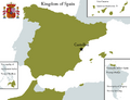
 Spain-page-001.jpg 1,495 × 1,058; 92 KB
 Spainmap-0.png 1,032 × 793; 114 KB
 Spanishcolony.png 1,717 × 835; 1.33 MB
 SpanishEmpireMap.png 4,378 × 2,435; 518 KB
 Sss.png 458 × 285; 109 KB
 Stuff.jpg 1,920 × 1,017; 188 KB
 Subwaymap2.png 1,200 × 1,016; 195 KB
 Suceava.jpg 1,366 × 768; 332 KB
 Suomikarttaemc4.png 2,282 × 1,138; 3.7 MB
 SuurSuomi.png 872 × 575; 882 KB
 Suursuomi1.png 2,294 × 1,262; 4.57 MB
 Suursuomi2.png 2,294 × 1,262; 4.52 MB
 SVALBARD.PNG 571 × 529; 104 KB
 Svalbardsubdivisons.png 700 × 740; 497 KB
 Svea map wikia political-0.png 543 × 531; 36 KB
 Svea map wikia political-1.png 543 × 531; 37 KB
 Svea map wikia political-2.png 543 × 531; 37 KB
 Svea map wikia political.png 543 × 531; 25 KB
 Svea map wikia-0.png 543 × 531; 19 KB
 Svea map wikia-1.png 543 × 531; 20 KB
 Svea map wikia-2.png 543 × 531; 20 KB
 Svea map wikia.png 543 × 531; 22 KB
 Sveucia map.png 543 × 531; 20 KB
 Sweden11March2019.png 1,028 × 670; 1.04 MB
 Swedish Finland Map.png 740 × 546; 474 KB
 T.png 1,108 × 673; 1.36 MB
 Takikawa.jpg 450 × 286; 48 KB
 Tarvistikov.png 1,027 × 585; 191 KB
 Tasiilaqmap.png 1,491 × 577; 209 KB
 Templar Map.png 2,048 × 2,021; 2.25 MB
 Tempsnip.png 1,712 × 618; 1,013 KB
 Terra mariana map.png 1,920 × 1,080; 4.45 MB
 Territoires.jpg 1,128 × 590; 134 KB
 Territoires.png 1,128 × 590; 629 KB
 Territory atacama.png 517 × 441; 385 KB
 Territory of Polish Kingdom.png 1,513 × 750; 159 KB
 The Battle.png 935 × 851; 135 KB
 The Great Balkan War.png 396 × 376; 180 KB
 The Holy Land.png 371 × 374; 36 KB
 The Region Of Atacama.png 354 × 441; 260 KB
 The second war of beijing .png 379 × 497; 393 KB
 The siege of Xi an.png 1,124 × 749; 788 KB
 Theodosiopolis.jpeg 2,388 × 1,668; 1.05 MB
 TheodosiopolisBig.jpeg 2,388 × 1,668; 1,021 KB
 Thisted after battle.png 681 × 491; 103 KB
 TK7PwWxaM58.jpg 739 × 807; 179 KB
 TOM.png 398 × 254; 237 KB
 Town borders.png 330 × 312; 84 KB
 Town map-0.png 334 × 265; 102 KB
 Town map.png 334 × 265; 82 KB
 Town.PNG 314 × 329; 15 KB
 TownMariana.png 351 × 182; 84 KB
 Trans-Scandinavian 1.png 1,575 × 891; 2.6 MB
 Transport Map.png 400 × 215; 130 KB
 Treaty of kiel.png 847 × 626; 608 KB
 Treatyofavalon-0.jpeg 640 × 674; 165 KB
 Treatyofavalon.jpeg 640 × 1,136; 193 KB
 Tri state map.png 334 × 386; 61 KB
- Error creating thumbnail: File with dimensions greater than 12.5 MPTriumvirateTerritory.png 7,200 × 3,318; 2.46 MB
 Tzarist.jpeg 2,388 × 1,668; 1.88 MB
- U.N-0. Directions MapU.N-0. Directions Map File missing
- U.N. Directions MapU.N. Directions Map File missing
 Unknow.png 1,110 × 541; 771 KB
 Unknown (1)-0.png 924 × 630; 1,011 KB


.png)
.png)
.png)
.png)
.png)
_LI.jpg)
.png)
.png)
.png)
.png)
.png)
.png)
.png)
.png)
.png)
.png)
.png)


-0.png)