Category:Maps: Difference between revisions
Jump to navigation
Jump to search
>Sitb m (Reverted edits by PrlcklyWasTaken (talk) to last version by Sitb) |
>Sitb m (Reverted edits by PrlcklyWasTaken (talk) to last version by Sitb) |
(No difference)
| |
Revision as of 12:24, 26 July 2020
Below is a list of maps depicting various regions of EarthMC. This category includes map images, as well as articles that are specifically dedicated to one or more maps.
Pages in category "Maps"
The following 3 pages are in this category, out of 3 total.
Media in category "Maps"
The following 200 files are in this category, out of 622 total.
(previous page) (next page)- Dominionofsiammap.png 732 × 458; 69 KB
- Donegal in Ireland.svg.png 361 × 450; 66 KB
- Download-1558448985.png 677 × 680; 278 KB
- Dumdum.png 643 × 425; 66 KB
- Dynmap-0.PNG 340 × 314; 51 KB
- Dynmap-191130-Zloty Stok.png 600 × 344; 275 KB
- Dynmap.PNG 748 × 539; 99 KB
- Dyraville Boomtown.PNG 1,675 × 782; 1.48 MB
- E5fb269b820587fcad1d0958ce8bc22d.png 845 × 576; 329 KB
- Early niigata plans.png 1,530 × 826; 1.34 MB
- EARTHMC Map.png 1,360 × 768; 1.22 MB
- Earthmc map.png 1,753 × 885; 1.83 MB
- EarthMC Server Map - Comodo Dragon 16 12 2018 14 33 56.png 1,366 × 736; 343 KB
- Earthmc-falklands.png 834 × 420; 111 KB
- Earthmccos.png 1,068 × 552; 681 KB
- Earthmcczechoslovakiamap.png 900 × 720; 343 KB
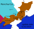
- EarthmcMapLiao5.20.png 483 × 413; 26 KB
- EastAus Map.png 1,565 × 898; 79 KB
- Ecfdb6c52ce212b.jpg 1,272 × 754; 134 KB
- Eindhoven map-0.PNG 892 × 456; 274 KB
- Eindhoven map.PNG 669 × 480; 134 KB
- ElectionMap.JPG 484 × 597; 36 KB
- ElyrianBorders.PNG 843 × 482; 207 KB
- EMC New York City.JPG 2,245 × 1,291; 614 KB
- Empirebordersandtowns rebels.png 1,191 × 886; 1.1 MB
- ETHICAR.png 800 × 460; 31 KB
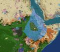
- EthioBorders.jpg 619 × 543; 127 KB
- Europecontinent.png 1,000 × 1,006; 128 KB
- EuropeEMC.png 1,213 × 613; 1.12 MB
- Extent of Cilician Armenia in 27.6.19.png 1,503 × 965; 804 KB
- F121E00E-750A-45A7-8860-2256E83AD374.png 2,388 × 1,668; 2.5 MB
- F56b6a4e-98ea-41e5-8863-89a210e7fd04.png 3,256 × 2,514; 401 KB
- F7eb8d15c5e65746fa9fbeb01eefdd58.png 855 × 586; 132 KB
- Fart .jpg 1,148 × 968; 196 KB
- Ferrocarril.jpg 544 × 474; 27 KB
- Finland frontier-0.png 792 × 600; 60 KB
- Finland frontier-1.png 792 × 600; 63 KB
- Finland frontier.png 792 × 600; 72 KB
- Finnish Sweden Map.png 740 × 546; 476 KB
- FlavorTown.png 301 × 233; 45 KB
- France-0.png 872 × 678; 705 KB
- France-page-001.jpg 1,495 × 1,058; 94 KB
- Francemap.png 1,446 × 845; 1.83 MB
- Frankfurt Bonne Border.png 1,000 × 573; 788 KB
- FuzeCity.JPG 1,375 × 1,005; 231 KB
- Fuzecity.JPG 713 × 785; 275 KB
- FuzeCity.PNG 519 × 453; 42 KB
- FwSFxfl9VWA.jpg 807 × 537; 113 KB
- Gangra.PNG 599 × 416; 109 KB
- Gdańsk.png 727 × 664; 373 KB
- GeneralTrade.png 1,702 × 833; 1.6 MB
- Geo-map-New-Zealand--contour (1).png 980 × 1,080; 76 KB
- Geographu.png 509 × 444; 69 KB
- Geography19326.PNG 478 × 447; 61 KB
- Germanopolis 112419.PNG 734 × 482; 149 KB
- Germanopolis 123019.PNG 835 × 597; 202 KB
- Ggggg.PNG 540 × 476; 228 KB
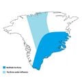
- Godthab territoire avec dominion.jpg 1,300 × 1,300; 148 KB
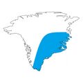
- Godthab territoire.jpg 1,300 × 1,300; 126 KB
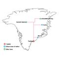
- Godthab transport.jpg 1,300 × 1,300; 156 KB
- Goop.png 1,291 × 678; 1.17 MB
- GRE.png 1,080 × 428; 912 KB
- Great Battle-0.png 220 × 306; 143 KB
- Great Battle.png 1,032 × 1,436; 2.3 MB
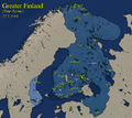
- Greater Finland Map.png 961 × 855; 935 KB
- GREClaimsOutdated.png 1,025 × 406; 786 KB
- GT42CV.png 1,334 × 677; 1.56 MB
- GulfofSiam.png 1,885 × 1,440; 191 KB
- Havana.png 280 × 192; 21 KB
- Hawaiian Islands.PNG 1,863 × 733; 99 KB
- Hefeistopolis.png 469 × 332; 71 KB
- Heraclea.png 1,080 × 683; 872 KB
- Hhhhhhhh.PNG 438 × 291; 30 KB
- Hhhhhhhhhhhh.png 397 × 303; 96 KB
- HonyBJTvooQ.jpg 1,080 × 895; 152 KB
- Iberian War.png 426 × 291; 57 KB
- Icerail.png 1,552 × 833; 112 KB
- Iceway map.png 922 × 775; 103 KB
- IceWay plans.PNG 437 × 525; 347 KB
- Image of Cozumel.PNG 567 × 501; 34 KB
- Image of region.png 784 × 604; 587 KB
- IMG 20191012 172519.jpg 858 × 866; 259 KB
- IMG 20191013 110109.jpg 858 × 866; 270 KB
- IMG 20191117 214448.jpg 1,593 × 848; 302 KB
- IMG-4416.JPG 1,444 × 1,058; 1.31 MB
- Imgd-0.PNG 548 × 873; 658 KB
- Imperialjapan.png 1,082 × 650; 1.22 MB
- ImperialJapanMap.png 1,198 × 721; 1.8 MB
- ImperialJapanMap2.png 1,710 × 832; 2.68 MB
- Incan Empire.png 644 × 757; 587 KB
- IndiaDarya.png 468 × 528; 199 KB
- Indochina.png 662 × 663; 701 KB
- IndochinaBorder.png 1,100 × 609; 105 KB
- Intermarium Claim Map.png 1,920 × 1,080; 3.06 MB
- Iron city.jpg 367 × 196; 30 KB
- ISP Regions.png 1,169 × 559; 856 KB
- ISP.png 1,169 × 559; 809 KB
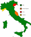
- Italiamap.jpg 419 × 506; 19 KB
- Japan august 31.png 1,135 × 793; 769 KB
- Japan november 17.jpg 926 × 877; 163 KB
- Japan1212121.png 1,347 × 878; 949 KB
- JGXEsmf.png 678 × 553; 141 KB
- Jhjh.jpg 1,795 × 839; 402 KB
- Juazeiro 2.png 794 × 572; 124 KB
- Kaiserreich.png 1,920 × 1,080; 877 KB
- Kane.PNG 1,238 × 650; 434 KB
- Error creating thumbnail: File with dimensions greater than 12.5 MPKarafuto innacurate claims.png 3,727 × 3,727; 582 KB
- KingdomOfNorwayTerritory.png 903 × 794; 181 KB
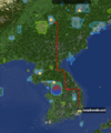
- KoreaMap.png 1,088 × 1,262; 109 KB
- KoreaTerritory.png 702 × 605; 521 KB
- Kosice.PNG 1,116 × 538; 678 KB
- Kuuul.png 2,344 × 1,442; 1.81 MB
- Error creating thumbnail: File with dimensions greater than 12.5 MPLa Plata 28 12 2018.png 6,600 × 6,639; 1.77 MB
- Error creating thumbnail: File with dimensions greater than 12.5 MPLa Plata Country Subdivisions.png 6,600 × 6,639; 1.56 MB
- La plata regions hd.png 1,742 × 1,740; 2.29 MB
- LIAO6.10LIAO6.10 File missing
- Location.jpg 842 × 770; 245 KB
- LOCATION.png 182 × 167; 24 KB
- Lomfjorden line.png 1,474 × 789; 170 KB
- Louquissimo.png 1,165 × 652; 1.78 MB
- Madagascar-Ecohaven.jpg 755 × 1,243; 460 KB
- MadagascarMap.jpg 2,000 × 3,840; 281 KB
- Map 1.PNG 675 × 709; 344 KB
- Map attaque sur baptiste.png 1,909 × 933; 184 KB
- Map for wiki.PNG 1,907 × 960; 1.68 MB
- Map I 2.gif 516 × 609; 34 KB
- Map of Asia.PNG 1,057 × 739; 883 KB
- Map of China revise 4.jpg 3,520 × 2,970; 1.66 MB
- Map of earthmc with names.png 2,000 × 1,333; 649 KB
- Map of Europe.png 1,699 × 754; 2.05 MB
- Map of Han 1.jpg 3,520 × 2,970; 1.68 MB
- Map of Italy (Earthmc).gif 547 × 657; 18 KB
- Map of Malygina, capital of Eurasia.png 571 × 329; 63 KB
- Map of Nations 2019 0614-0.png 2,000 × 1,333; 885 KB
- Map of Nations 2019 0614.png 2,000 × 1,333; 869 KB
- Map Of Participants.PNG 1,519 × 729; 2.16 MB
- Map of Patagonia.png 1,295 × 1,680; 412 KB
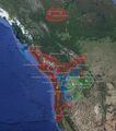
- Map of PNW EarthMC.jpg 2,500 × 1,649; 501 KB
- Map of Quebec as of the 18th November 2020.png 1,060 × 560; 749 KB
- Map of the Different Countries in the Pacific Northwest.jpg 619 × 698; 211 KB
- Map sibir nov.png 396 × 199; 158 KB
- MAP-0.jpg 834 × 564; 535 KB
- Map-0.png 926 × 510; 863 KB
- MAP-1.jpg 1,239 × 538; 733 KB
- Map-1559788551.png 835 × 410; 823 KB
- MAP.jpg 834 × 564; 514 KB
- Map.JPG 1,125 × 719; 171 KB
- Map.PNG 1,458 × 817; 653 KB
- Map.png 1,920 × 1,010; 733 KB
- Map1-0.png 1,338 × 1,312; 852 KB
- Map1.png 1,008 × 680; 815 KB
- Mapa earthmc.png 916 × 584; 1.2 MB
- MapCZSK4.png 1,163 × 728; 97 KB
- Mapguenole.PNG 918 × 630; 619 KB
- MapOfelyria.PNG 882 × 681; 242 KB
- MapOfJapan.png 1,473 × 957; 1.74 MB
- Mapofpisa.png 1,318 × 1,641; 430 KB
- Masset 2019 0822.png 1,084 × 869; 413 KB
- MemphisMap1.png 2,388 × 1,668; 1.23 MB
- MemphisPic2.jpeg 2,085 × 1,388; 1.68 MB
- Mersa.png 172 × 198; 42 KB
- Mersa2.png 114 × 132; 26 KB
- Mersa3.PNG 505 × 494; 121 KB
- Mersaclaims.PNG 673 × 753; 367 KB
- MichiganClaimsUpdated.jpg 1,000 × 720; 73 KB
- Monaco-page-001(1).jpg 1,000 × 708; 203 KB
- Error creating thumbnail: File with dimensions greater than 12.5 MPMongolempiremapwiki.png 6,930 × 5,291; 1.91 MB
- Montego Bay.png 1,920 × 1,080; 547 KB
- Moravian forces.png 776 × 679; 91 KB
- Mossow.PNG 272 × 159; 36 KB
- MossowAnt.PNG 339 × 297; 49 KB
- N16Vntb.jpg 1,170 × 899; 238 KB
- Narvik 3.09.19.png 1,073 × 728; 215 KB
- Nations.png 1,677 × 917; 271 KB
- Naus map.png 479 × 551; 418 KB
- Naus region dynmap.png 479 × 551; 706 KB
- Nd Chile.png 1,278 × 870; 759 KB
- Netherlands map.PNG 588 × 649; 351 KB
- Netherlands-page-001(1).jpg 1,000 × 708; 213 KB
- Nevada map.png 746 × 744; 11 KB
- New Bianjie Agreement.png 610 × 862; 512 KB
- New spain.png 1,284 × 1,005; 1.81 MB
- Newburn Districts Map.png 937 × 719; 238 KB
- Newburn.png 937 × 719; 176 KB
- NewEthio.jpg 619 × 543; 126 KB
- Newfoundlandpolitical.png 832 × 573; 477 KB
- NewMap.png 459 × 534; 328 KB
- NFLD-NS.png 335 × 339; 161 KB
- Niigata last day of existence.png 878 × 577; 381 KB
- Niigata nameplan.png 1,610 × 848; 896 KB
- North America EarthMC.png 1,089 × 612; 258 KB
- North America Silhouette.png 1,088 × 1,280; 66 KB
- North Yorkshire District Map.png 804 × 325; 243 KB
- Northamericamap.png 709 × 641; 125 KB
- Northeast 6.10.png 1,220 × 824; 1.48 MB
- Northern New Spain.png 805 × 594; 501 KB
- Norwegian Territory.png 334 × 256; 147 KB
- Norwegianraid.png 988 × 598; 903 KB
- NPS location.jpg 3,565 × 3,000; 888 KB
- NPSterritorry.png 678 × 491; 184 KB


