Category:Maps
Jump to navigation
Jump to search
I have no Idea why this would be made, this is literally just a bunch of screenshots from
https://earthmc.net/classic/map/ put in a category...
Pages in category "Maps"
The following 3 pages are in this category, out of 3 total.
Media in category "Maps"
The following 200 files are in this category, out of 622 total.
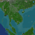
(previous page) (next page)- Dominionofsiammap.png 732 × 458; 69 KB
- Donegal in Ireland.svg.png 361 × 450; 66 KB
- Download-1558448985.png 677 × 680; 278 KB
- Dumdum.png 643 × 425; 66 KB
- Dynmap-0.PNG 340 × 314; 51 KB
- Dynmap-191130-Zloty Stok.png 600 × 344; 275 KB
- Dynmap.PNG 748 × 539; 99 KB
- Dyraville Boomtown.PNG 1,675 × 782; 1.48 MB
- E5fb269b820587fcad1d0958ce8bc22d.png 845 × 576; 329 KB
- Early niigata plans.png 1,530 × 826; 1.34 MB
- EARTHMC Map.png 1,360 × 768; 1.22 MB
- Earthmc map.png 1,753 × 885; 1.83 MB
- EarthMC Server Map - Comodo Dragon 16 12 2018 14 33 56.png 1,366 × 736; 343 KB
- Earthmc-falklands.png 834 × 420; 111 KB
- Earthmccos.png 1,068 × 552; 681 KB
- Earthmcczechoslovakiamap.png 900 × 720; 343 KB
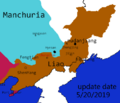
- EarthmcMapLiao5.20.png 483 × 413; 26 KB
- EastAus Map.png 1,565 × 898; 79 KB
- Ecfdb6c52ce212b.jpg 1,272 × 754; 134 KB
- Eindhoven map-0.PNG 892 × 456; 274 KB
- Eindhoven map.PNG 669 × 480; 134 KB
- ElectionMap.JPG 484 × 597; 36 KB
- ElyrianBorders.PNG 843 × 482; 207 KB
- EMC New York City.JPG 2,245 × 1,291; 614 KB
- Empirebordersandtowns rebels.png 1,191 × 886; 1.1 MB
- ETHICAR.png 800 × 460; 31 KB
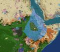
- EthioBorders.jpg 619 × 543; 127 KB
- Europecontinent.png 1,000 × 1,006; 128 KB
- EuropeEMC.png 1,213 × 613; 1.12 MB
- Extent of Cilician Armenia in 27.6.19.png 1,503 × 965; 804 KB
- F121E00E-750A-45A7-8860-2256E83AD374.png 2,388 × 1,668; 2.5 MB
- F56b6a4e-98ea-41e5-8863-89a210e7fd04.png 3,256 × 2,514; 401 KB
- F7eb8d15c5e65746fa9fbeb01eefdd58.png 855 × 586; 132 KB
- Fart .jpg 1,148 × 968; 196 KB
- Ferrocarril.jpg 544 × 474; 27 KB
- Finland frontier-0.png 792 × 600; 60 KB
- Finland frontier-1.png 792 × 600; 63 KB
- Finland frontier.png 792 × 600; 72 KB
- Finnish Sweden Map.png 740 × 546; 476 KB
- FlavorTown.png 301 × 233; 45 KB
- France-0.png 872 × 678; 705 KB
- France-page-001.jpg 1,495 × 1,058; 94 KB
- Francemap.png 1,446 × 845; 1.83 MB
- Frankfurt Bonne Border.png 1,000 × 573; 788 KB
- FuzeCity.JPG 1,375 × 1,005; 231 KB
- Fuzecity.JPG 713 × 785; 275 KB
- FuzeCity.PNG 519 × 453; 42 KB
- FwSFxfl9VWA.jpg 807 × 537; 113 KB
- Gangra.PNG 599 × 416; 109 KB
- Gdańsk.png 727 × 664; 373 KB
- GeneralTrade.png 1,702 × 833; 1.6 MB
- Geo-map-New-Zealand--contour (1).png 980 × 1,080; 76 KB
- Geographu.png 509 × 444; 69 KB
- Geography19326.PNG 478 × 447; 61 KB
- Germanopolis 112419.PNG 734 × 482; 149 KB
- Germanopolis 123019.PNG 835 × 597; 202 KB
- Ggggg.PNG 540 × 476; 228 KB
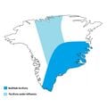
- Godthab territoire avec dominion.jpg 1,300 × 1,300; 148 KB
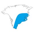
- Godthab territoire.jpg 1,300 × 1,300; 126 KB
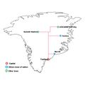
- Godthab transport.jpg 1,300 × 1,300; 156 KB
- Goop.png 1,291 × 678; 1.17 MB
- GRE.png 1,080 × 428; 912 KB
- Great Battle-0.png 220 × 306; 143 KB
- Great Battle.png 1,032 × 1,436; 2.3 MB
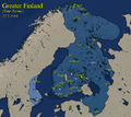
- Greater Finland Map.png 961 × 855; 935 KB
- GREClaimsOutdated.png 1,025 × 406; 786 KB
- GT42CV.png 1,334 × 677; 1.56 MB
- GulfofSiam.png 1,885 × 1,440; 191 KB
- Havana.png 280 × 192; 21 KB
- Hawaiian Islands.PNG 1,863 × 733; 99 KB
- Hefeistopolis.png 469 × 332; 71 KB
- Heraclea.png 1,080 × 683; 872 KB
- Hhhhhhhh.PNG 438 × 291; 30 KB
- Hhhhhhhhhhhh.png 397 × 303; 96 KB
- HonyBJTvooQ.jpg 1,080 × 895; 152 KB
- Iberian War.png 426 × 291; 57 KB
- Icerail.png 1,552 × 833; 112 KB
- Iceway map.png 922 × 775; 103 KB
- IceWay plans.PNG 437 × 525; 347 KB
- Image of Cozumel.PNG 567 × 501; 34 KB
- Image of region.png 784 × 604; 587 KB
- IMG 20191012 172519.jpg 858 × 866; 259 KB
- IMG 20191013 110109.jpg 858 × 866; 270 KB
- IMG 20191117 214448.jpg 1,593 × 848; 302 KB
- IMG-4416.JPG 1,444 × 1,058; 1.31 MB
- Imgd-0.PNG 548 × 873; 658 KB
- Imperialjapan.png 1,082 × 650; 1.22 MB
- ImperialJapanMap.png 1,198 × 721; 1.8 MB
- ImperialJapanMap2.png 1,710 × 832; 2.68 MB
- Incan Empire.png 644 × 757; 587 KB
- IndiaDarya.png 468 × 528; 199 KB
- Indochina.png 662 × 663; 701 KB
- IndochinaBorder.png 1,100 × 609; 105 KB
- Intermarium Claim Map.png 1,920 × 1,080; 3.06 MB
- Iron city.jpg 367 × 196; 30 KB
- ISP Regions.png 1,169 × 559; 856 KB
- ISP.png 1,169 × 559; 809 KB
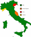
- Italiamap.jpg 419 × 506; 19 KB
- Japan august 31.png 1,135 × 793; 769 KB
- Japan november 17.jpg 926 × 877; 163 KB
- Japan1212121.png 1,347 × 878; 949 KB
- JGXEsmf.png 678 × 553; 141 KB
- Jhjh.jpg 1,795 × 839; 402 KB
- Juazeiro 2.png 794 × 572; 124 KB
- Kaiserreich.png 1,920 × 1,080; 877 KB
- Kane.PNG 1,238 × 650; 434 KB
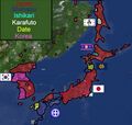
- Error creating thumbnail: File with dimensions greater than 12.5 MPKarafuto innacurate claims.png 3,727 × 3,727; 582 KB
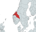
- KingdomOfNorwayTerritory.png 903 × 794; 181 KB
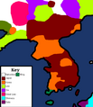
- KoreaMap.png 1,088 × 1,262; 109 KB
- KoreaTerritory.png 702 × 605; 521 KB
- Kosice.PNG 1,116 × 538; 678 KB
- Kuuul.png 2,344 × 1,442; 1.81 MB
- Error creating thumbnail: File with dimensions greater than 12.5 MPLa Plata 28 12 2018.png 6,600 × 6,639; 1.77 MB
- Error creating thumbnail: File with dimensions greater than 12.5 MPLa Plata Country Subdivisions.png 6,600 × 6,639; 1.56 MB
- La plata regions hd.png 1,742 × 1,740; 2.29 MB
- LIAO6.10LIAO6.10 File missing
- Location.jpg 842 × 770; 245 KB
- LOCATION.png 182 × 167; 24 KB
- Lomfjorden line.png 1,474 × 789; 170 KB
- Louquissimo.png 1,165 × 652; 1.78 MB
- Madagascar-Ecohaven.jpg 755 × 1,243; 460 KB
- MadagascarMap.jpg 2,000 × 3,840; 281 KB
- Map 1.PNG 675 × 709; 344 KB
- Map attaque sur baptiste.png 1,909 × 933; 184 KB
- Map for wiki.PNG 1,907 × 960; 1.68 MB
- Map I 2.gif 516 × 609; 34 KB
- Map of Asia.PNG 1,057 × 739; 883 KB
- Map of China revise 4.jpg 3,520 × 2,970; 1.66 MB
- Map of earthmc with names.png 2,000 × 1,333; 649 KB
- Map of Europe.png 1,699 × 754; 2.05 MB
- Map of Han 1.jpg 3,520 × 2,970; 1.68 MB
- Map of Italy (Earthmc).gif 547 × 657; 18 KB
- Map of Malygina, capital of Eurasia.png 571 × 329; 63 KB
- Map of Nations 2019 0614-0.png 2,000 × 1,333; 885 KB
- Map of Nations 2019 0614.png 2,000 × 1,333; 869 KB
- Map Of Participants.PNG 1,519 × 729; 2.16 MB
- Map of Patagonia.png 1,295 × 1,680; 412 KB
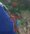
- Map of PNW EarthMC.jpg 2,500 × 1,649; 501 KB
- Map of Quebec as of the 18th November 2020.png 1,060 × 560; 749 KB
- Map of the Different Countries in the Pacific Northwest.jpg 619 × 698; 211 KB
- Map sibir nov.png 396 × 199; 158 KB
- MAP-0.jpg 834 × 564; 535 KB
- Map-0.png 926 × 510; 863 KB
- MAP-1.jpg 1,239 × 538; 733 KB
- Map-1559788551.png 835 × 410; 823 KB
- MAP.jpg 834 × 564; 514 KB
- Map.JPG 1,125 × 719; 171 KB
- Map.PNG 1,458 × 817; 653 KB
- Map.png 1,920 × 1,010; 733 KB
- Map1-0.png 1,338 × 1,312; 852 KB
- Map1.png 1,008 × 680; 815 KB
- Mapa earthmc.png 916 × 584; 1.2 MB
- MapCZSK4.png 1,163 × 728; 97 KB
- Mapguenole.PNG 918 × 630; 619 KB
- MapOfelyria.PNG 882 × 681; 242 KB
- MapOfJapan.png 1,473 × 957; 1.74 MB
- Mapofpisa.png 1,318 × 1,641; 430 KB
- Masset 2019 0822.png 1,084 × 869; 413 KB
- MemphisMap1.png 2,388 × 1,668; 1.23 MB
- MemphisPic2.jpeg 2,085 × 1,388; 1.68 MB
- Mersa.png 172 × 198; 42 KB
- Mersa2.png 114 × 132; 26 KB
- Mersa3.PNG 505 × 494; 121 KB
- Mersaclaims.PNG 673 × 753; 367 KB
- MichiganClaimsUpdated.jpg 1,000 × 720; 73 KB
- Monaco-page-001(1).jpg 1,000 × 708; 203 KB
- Error creating thumbnail: File with dimensions greater than 12.5 MPMongolempiremapwiki.png 6,930 × 5,291; 1.91 MB
- Montego Bay.png 1,920 × 1,080; 547 KB
- Moravian forces.png 776 × 679; 91 KB
- Mossow.PNG 272 × 159; 36 KB
- MossowAnt.PNG 339 × 297; 49 KB
- N16Vntb.jpg 1,170 × 899; 238 KB
- Narvik 3.09.19.png 1,073 × 728; 215 KB
- Nations.png 1,677 × 917; 271 KB
- Naus map.png 479 × 551; 418 KB
- Naus region dynmap.png 479 × 551; 706 KB
- Nd Chile.png 1,278 × 870; 759 KB
- Netherlands map.PNG 588 × 649; 351 KB
- Netherlands-page-001(1).jpg 1,000 × 708; 213 KB
- Nevada map.png 746 × 744; 11 KB
- New Bianjie Agreement.png 610 × 862; 512 KB
- New spain.png 1,284 × 1,005; 1.81 MB
- Newburn Districts Map.png 937 × 719; 238 KB
- Newburn.png 937 × 719; 176 KB
- NewEthio.jpg 619 × 543; 126 KB
- Newfoundlandpolitical.png 832 × 573; 477 KB
- NewMap.png 459 × 534; 328 KB
- NFLD-NS.png 335 × 339; 161 KB
- Niigata last day of existence.png 878 × 577; 381 KB
- Niigata nameplan.png 1,610 × 848; 896 KB
- North America EarthMC.png 1,089 × 612; 258 KB
- North America Silhouette.png 1,088 × 1,280; 66 KB
- North Yorkshire District Map.png 804 × 325; 243 KB
- Northamericamap.png 709 × 641; 125 KB
- Northeast 6.10.png 1,220 × 824; 1.48 MB
- Northern New Spain.png 805 × 594; 501 KB
- Norwegian Territory.png 334 × 256; 147 KB
- Norwegianraid.png 988 × 598; 903 KB
- NPS location.jpg 3,565 × 3,000; 888 KB
- NPSterritorry.png 678 × 491; 184 KB


