Category:Maps
Jump to navigation
Jump to search
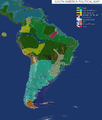
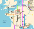
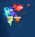
I have no Idea why this would be made, this is literally just a bunch of screenshots from
https://earthmc.net/classic/map/ put in a category...
Pages in category "Maps"
The following 3 pages are in this category, out of 3 total.
Media in category "Maps"
The following 200 files are in this category, out of 622 total.
(previous page) (next page)- NPSterritorry2.png 678 × 491; 185 KB
- Nt chile.png 1,278 × 870; 759 KB
- NubiaControl26Nov.png 1,074 × 877; 1.69 MB
- NubiaYemen.png 1,249 × 740; 1.64 MB
- Nz lol.png 1,010 × 835; 292 KB
- NZ Territory.png 1,122 × 772; 69 KB
- Oban wiki.png 1,390 × 767; 1.25 MB
- Official map.png 500 × 487; 63 KB
- Ok-0.png 444 × 254; 17 KB
- Old Hankou.png 600 × 696; 117 KB
- Omitama.png 754 × 548; 82 KB
- Ooga.png 1,338 × 463; 384 KB
- Outline.JPG 746 × 825; 80 KB
- Overheadramreemap.png 519 × 573; 275 KB
- Owari Map 2020.1.10.png 1,086 × 860; 449 KB
- Pankokosik.png 270 × 165; 6 KB
- Papua.png 822 × 460; 211 KB
- Patapolis.png 1,527 × 967; 575 KB
- Peak cascadia.png 1,670 × 936; 48 KB
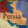
- Persia Claim Map.jpg 459 × 459; 88 KB
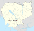
- PhnomPenh.png 224 × 203; 30 KB
- Plan agrandissment residentiel nuit.jpg 1,920 × 1,570; 2.32 MB
- Plan agrandissment residentiel.jpg 1,920 × 1,570; 3.94 MB
- Plan residentiel Est delimited .jpg 1,550 × 1,322; 2.26 MB
- Plan.cathedrale.Mans.png 1,529 × 836; 376 KB
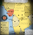
- Pol india map.png 684 × 719; 413 KB
- Polish map 02.06.2019.png 1,000 × 481; 469 KB
- PolishKingdomMap.png 2,753 × 1,400; 63 KB
- PolishMap.png 1,920 × 1,080; 3.06 MB
- PolishTerritory2018.png 1,440 × 581; 1.23 MB
- Political Map of China.jpg 3,520 × 2,970; 1.66 MB
- Political Map of Northern Europe.png 1,280 × 984; 1.87 MB
- Poop.png 363 × 384; 84 KB
- Portugal-page-001-0.jpg 1,495 × 1,058; 67 KB
- Portugal-page-001.jpg 1,495 × 1,058; 65 KB
- Posio.jpg 1,444 × 817; 276 KB
- Pourfanos.png 555 × 413; 294 KB
- PrefectureGRE.png 400 × 154; 136 KB
- Present from Franz 2019-07-28 04.05.23Present from Franz 2019-07-28 04.05.23 File missing
- Prilep Overview.png 773 × 515; 133 KB
- Pripyat - Districts .png 1,575 × 806; 1.3 MB
- Project AlfredPhase One.png 818 × 818; 153 KB
- Projeto são sebastião1.jpg 1,692 × 1,032; 915 KB
- Province Map 8 30.PNG 596 × 408; 125 KB
- Provinces.PNG 699 × 405; 573 KB
- Qing political map.jpg 1,761 × 1,795; 3.04 MB
- Qing Territory.png 3,930 × 2,048; 347 KB
- Raktown WAR.png 288 × 357; 60 KB
- RebelScot1.png 430 × 405; 216 KB
- Regions-0.png 965 × 676; 101 KB
- Error creating thumbnail: File with dimensions greater than 12.5 MPRegions.png 6,930 × 5,291; 1.87 MB
- Riau1-0.PNG 562 × 596; 31 KB
- Riau1.PNG 133 × 149; 11 KB
- Riau2-0.PNG 1,381 × 1,010; 493 KB
- Riau2.PNG 691 × 505; 390 KB
- RoadSystem.png 653 × 464; 642 KB
- Roanapur 2.PNG 682 × 697; 334 KB
- Roanapur 3.PNG 678 × 669; 309 KB
- Roanapur 4.PNG 639 × 667; 295 KB
- Roop land territory.jpg 1,148 × 968; 197 KB
- Rostock-0.png 1,225 × 670; 716 KB
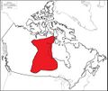
- Rup.jpg 2,040 × 1,320; 276 KB
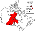
- Rupe land.jpg 2,040 × 1,320; 435 KB
- Rupert.png 2,099 × 1,845; 455 KB
- Ruperts Land Territory.jpg 2,040 × 1,320; 443 KB
- SA.png 570 × 473; 51 KB
- Safe Trading Location.jpg 451 × 377; 47 KB
- Sarawak.png 615 × 643; 267 KB
- Sasd.png 690 × 798; 272 KB
- Satan.JPG 482 × 497; 54 KB
- SAU.jpg 900 × 1,220; 71 KB
- Saudiarabiamap.png 670 × 455; 433 KB
- Scotlandmap - Copy.JPG 983 × 876; 317 KB
- Screen Shot 2019-03-07 at 6.13.54 pm.png 226 × 187; 74 KB
- Screen Shot 2019-04-08 at 7.38.40 PM.png 901 × 625; 1,000 KB
- Screen Shot 2019-04-18 at 8.19.21 PM.png 873 × 571; 522 KB
- Screen Shot 2019-04-22 at 12.00.32 PM.png 475 × 428; 166 KB
- Screen Shot 2019-06-16 at 11.06.55 AM.png 1,337 × 904; 1.32 MB
- Screen Shot 2019-08-22 at 15.02.52.png 425 × 335; 119 KB
- Screen Shot 2019-12-11 at 15.03.32.png 425 × 613; 272 KB
- Screen Shot 2021-01-14 at 11.22.37 AM.png 368 × 410; 310 KB
- Screenshot (258).png 866 × 723; 532 KB
- Screenshot (268).png 691 × 752; 118 KB
- Screenshot (3).png 284 × 391; 126 KB
- Screenshot (4).png 1,638 × 962; 288 KB
- Screenshot (46).png 427 × 523; 256 KB
- Screenshot (59) LI.jpg 1,758 × 944; 288 KB
- Screenshot (61).png 1,360 × 768; 1.27 MB
- Screenshot (62).png 1,360 × 768; 891 KB
- Screenshot (63).png 1,360 × 768; 82 KB
- Screenshot (64).png 740 × 566; 303 KB
- Screenshot (66).png 1,360 × 768; 226 KB
- Screenshot (67).png 1,360 × 768; 850 KB
- Screenshot (68).png 1,360 × 768; 703 KB
- Screenshot (70).png 1,360 × 768; 184 KB
- Screenshot (71).png 1,360 × 768; 272 KB
- Screenshot (74).png 1,360 × 768; 734 KB
- Screenshot (99).png 677 × 677; 96 KB
- Screenshot 1-0.png 348 × 311; 49 KB
- Screenshot 1.png 565 × 411; 166 KB
- Screenshot 2018-10-26 at 8.56.23 PM.png 335 × 403; 127 KB
- Screenshot 2018-11-15 at 9.58.38 AM.png 824 × 449; 64 KB
- Screenshot 2018-11-15 at 9.jpg 824 × 449; 228 KB
- Screenshot 20191111 112321 com.android.chrome.jpg 1,080 × 2,244; 398 KB
- Screenshot 20191111 191458.png 991 × 629; 308 KB
- Screenshot 20191115 142028 com.android.chrome.jpg 1,080 × 2,244; 363 KB
- Screenshot 283.png 871 × 481; 168 KB
- Screenshot 39.png 840 × 626; 382 KB
- Screenshot 52.png 902 × 680; 358 KB
- Screenshot 6-0.png 347 × 215; 23 KB
- Screenshot 6.png 487 × 326; 86 KB
- Screenshot 7.png 359 × 260; 25 KB
- Screenshot90.png 504 × 389; 63 KB
- SecondNubianEmpire.png 1,249 × 740; 1.74 MB
- SecondNubianEmpire2.png 1,249 × 740; 1.68 MB
- Sesgcp1-0.png 660 × 462; 352 KB
- Sesgcp1.png 660 × 462; 352 KB
- Shiga early.png 1,920 × 1,017; 4.6 MB
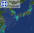
- Shimazu Map October2.png 1,554 × 1,498; 1.19 MB
- Shinkansen Network 2020.1.10.png 2,070 × 1,698; 217 KB
- Error creating thumbnail: File with dimensions greater than 12.5 MPSiam-0.png 4,558 × 4,233; 726 KB
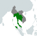
- SIAMTERRITORY.png 1,038 × 818; 96 KB
- SiamTerritory.png 615 × 608; 38 KB
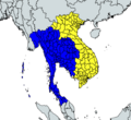
- Siamvietnam.png 583 × 535; 105 KB
- Siege of warsaw.png 1,032 × 1,436; 2.3 MB
- Siege.png 1,416 × 854; 271 KB
- Sketch-1570926450738.png 1,920 × 1,034; 242 KB
- Sketch-1574939432738.png 1,920 × 772; 1.67 MB
- Sketch-1575021885304.png 1,920 × 773; 467 KB
- Sketch-1576148718582.png 1,920 × 745; 1.63 MB
- Sketch-1580209106809.png 1,920 × 768; 2.12 MB
- Society.jpg 444 × 470; 37 KB
- South America Map.png 1,761 × 2,065; 2.12 MB
- South America.png 564 × 819; 512 KB
- South america.png 1,782 × 2,561; 139 KB
- Southamerica10.jpg 1,689 × 1,028; 1.23 MB
- Spain-page-001.jpg 1,495 × 1,058; 92 KB
- Spainmap-0.png 1,032 × 793; 114 KB
- Spanishcolony.png 1,717 × 835; 1.33 MB
- SpanishEmpireMap.png 4,378 × 2,435; 518 KB
- Sss.png 458 × 285; 109 KB
- Stuff.jpg 1,920 × 1,017; 188 KB
- Subwaymap2.png 1,200 × 1,016; 195 KB
- Suceava.jpg 1,366 × 768; 332 KB
- Suomikarttaemc4.png 2,282 × 1,138; 3.7 MB
- SuurSuomi.png 872 × 575; 882 KB
- Suursuomi1.png 2,294 × 1,262; 4.57 MB
- Suursuomi2.png 2,294 × 1,262; 4.52 MB
- SVALBARD.PNG 571 × 529; 104 KB
- Svalbardsubdivisons.png 700 × 740; 497 KB
- Svea map wikia political-0.png 543 × 531; 36 KB
- Svea map wikia political-1.png 543 × 531; 37 KB
- Svea map wikia political-2.png 543 × 531; 37 KB
- Svea map wikia political.png 543 × 531; 25 KB
- Svea map wikia-0.png 543 × 531; 19 KB
- Svea map wikia-1.png 543 × 531; 20 KB
- Svea map wikia-2.png 543 × 531; 20 KB
- Svea map wikia.png 543 × 531; 22 KB
- Sveucia map.png 543 × 531; 20 KB
- Sweden11March2019.png 1,028 × 670; 1.04 MB
- Swedish Finland Map.png 740 × 546; 474 KB
- T.png 1,108 × 673; 1.36 MB
- Takikawa.jpg 450 × 286; 48 KB
- Tarvistikov.png 1,027 × 585; 191 KB
- Tasiilaqmap.png 1,491 × 577; 209 KB
- Templar Map.png 2,048 × 2,021; 2.25 MB
- Tempsnip.png 1,712 × 618; 1,013 KB
- Terra mariana map.png 1,920 × 1,080; 4.45 MB
- Territoires.jpg 1,128 × 590; 134 KB
- Territoires.png 1,128 × 590; 629 KB
- Territory atacama.png 517 × 441; 385 KB
- Territory of Polish Kingdom.png 1,513 × 750; 159 KB
- The Battle.png 935 × 851; 135 KB
- The Great Balkan War.png 396 × 376; 180 KB
- The Holy Land.png 371 × 374; 36 KB
- The Region Of Atacama.png 354 × 441; 260 KB
- The second war of beijing .png 379 × 497; 393 KB
- The siege of Xi an.png 1,124 × 749; 788 KB
- Theodosiopolis.jpeg 2,388 × 1,668; 1.05 MB
- TheodosiopolisBig.jpeg 2,388 × 1,668; 1,021 KB
- Thisted after battle.png 681 × 491; 103 KB
- TK7PwWxaM58.jpg 739 × 807; 179 KB
- TOM.png 398 × 254; 237 KB
- Town borders.png 330 × 312; 84 KB
- Town map-0.png 334 × 265; 102 KB
- Town map.png 334 × 265; 82 KB
- Town.PNG 314 × 329; 15 KB
- TownMariana.png 351 × 182; 84 KB
- Trans-Scandinavian 1.png 1,575 × 891; 2.6 MB
- Transport Map.png 400 × 215; 130 KB
- Treaty of kiel.png 847 × 626; 608 KB
- Treatyofavalon-0.jpeg 640 × 674; 165 KB
- Treatyofavalon.jpeg 640 × 1,136; 193 KB
- Tri state map.png 334 × 386; 61 KB
- Error creating thumbnail: File with dimensions greater than 12.5 MPTriumvirateTerritory.png 7,200 × 3,318; 2.46 MB
- Tzarist.jpeg 2,388 × 1,668; 1.88 MB
- U.N-0. Directions MapU.N-0. Directions Map File missing
- U.N. Directions MapU.N. Directions Map File missing
- Unknow.png 1,110 × 541; 771 KB
- Unknown (1)-0.png 924 × 630; 1,011 KB


