File:RonneFreeTerritoryMap.png
Jump to navigation
Jump to search

Size of this preview: 800 × 562 pixels. Other resolution: 2,276 × 1,600 pixels.
Original file (2,276 × 1,600 pixels, file size: 1.44 MB, MIME type: image/png)
File history
Click on a date/time to view the file as it appeared at that time.
| Date/Time | Thumbnail | Dimensions | User | Comment | |
|---|---|---|---|---|---|
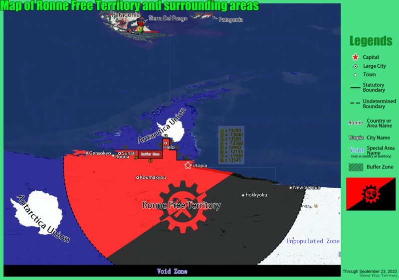
| current | 10:34, 25 October 2023 | | 2,276 × 1,600 (1.44 MB) | 181cm (talk | contribs) | |
| 16:09, 30 August 2023 | 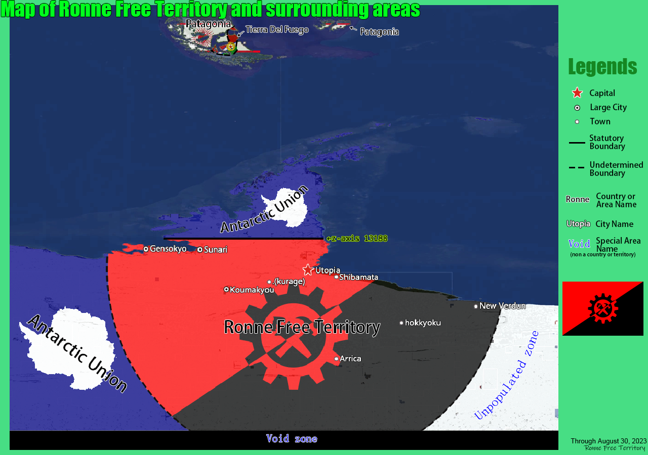 | 1,280 × 900 (647 KB) | 181cm (talk | contribs) | ||
| 15:46, 26 January 2023 | 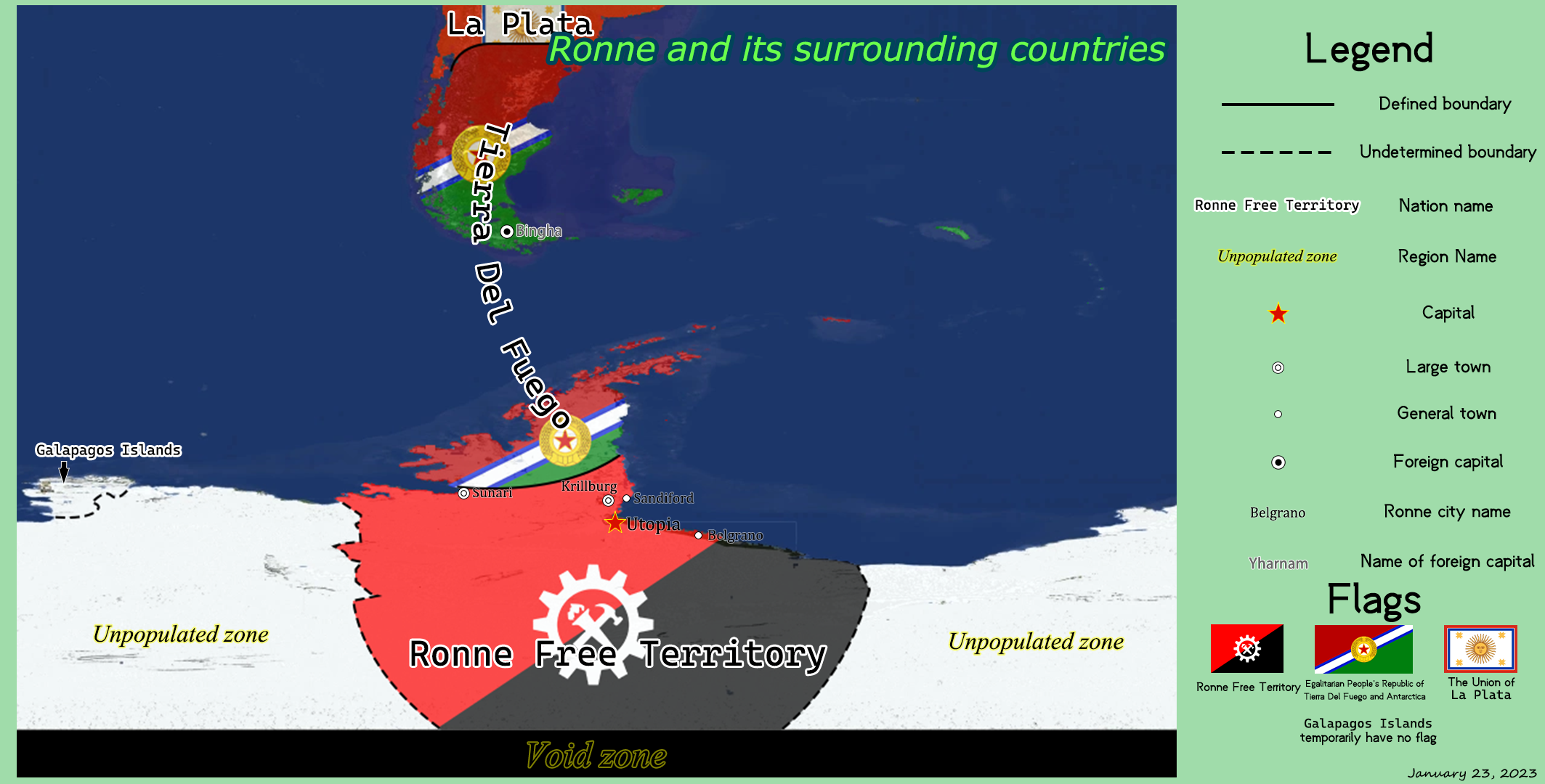 | 2,127 × 1,080 (921 KB) | 181cm (talk | contribs) | ||
| 14:11, 29 December 2022 | 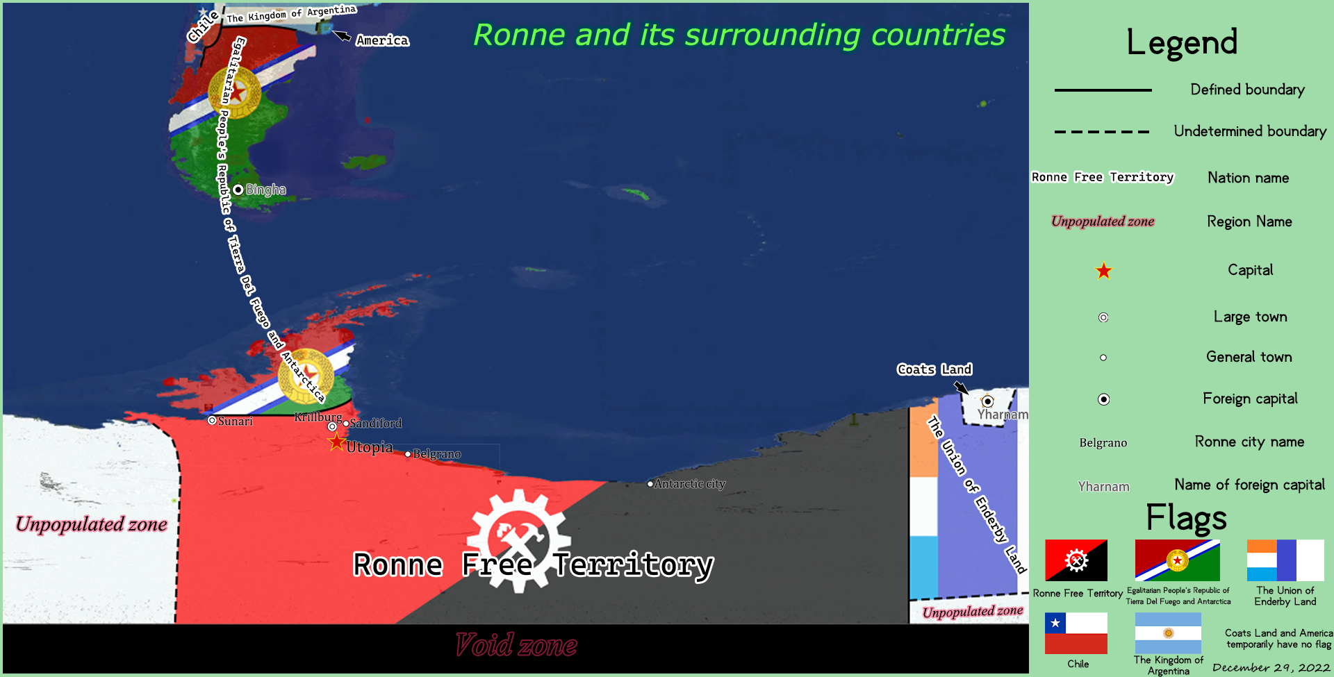 | 1,920 × 975 (816 KB) | 181cm (talk | contribs) | ||
| 21:15, 15 December 2022 | 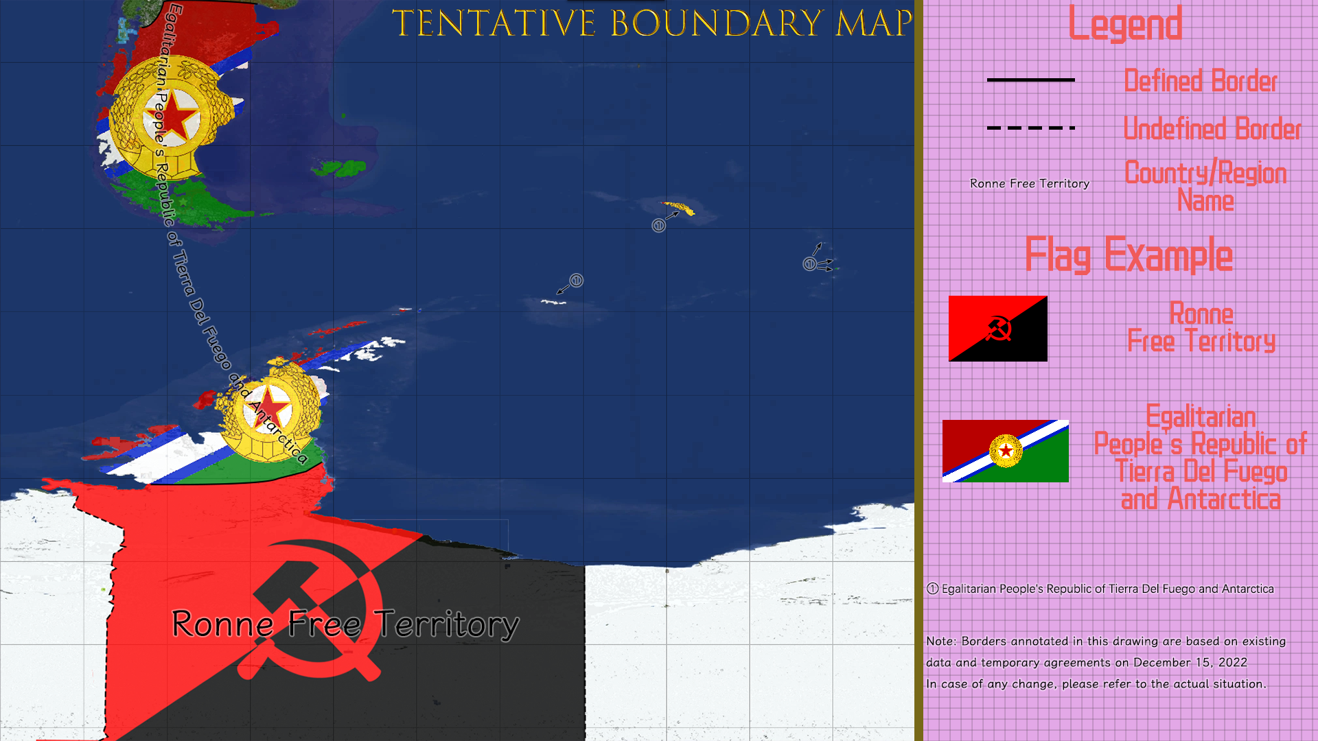 | 1,920 × 1,080 (1.06 MB) | 181cm (talk | contribs) | ||
| 17:28, 25 November 2022 | 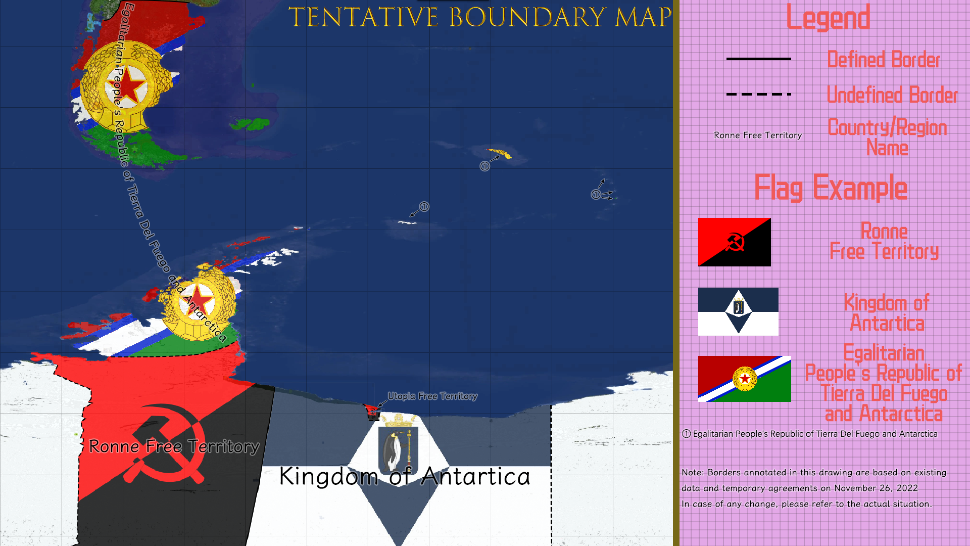 | 1,920 × 1,080 (972 KB) | 181cm (talk | contribs) |
You cannot overwrite this file.
File usage
The following 6 pages use this file: