Aurora:Saint-Malo: Difference between revisions
No edit summary |
mNo edit summary |
||
| Line 13: | Line 13: | ||
== Territory == | == Territory == | ||
[[File:St-malo-schema.jpg|thumb|300px| | [[File:St-malo-schema.jpg|thumb|300px|Old plans of the town]] | ||
=== Geographics === | === Geographics === | ||
| Line 31: | Line 31: | ||
==== Freeway ==== | ==== Freeway ==== | ||
[[File:St-malo-Freeway-18-05-2022.png|thumb|300px| | [[File:St-malo-Freeway-18-05-2022.png|thumb|300px|The Freeway]] | ||
The most iconic building of the town is the two large freeways that span over the town, edge to edge. | The most iconic building of the town is the two large freeways that span over the town, edge to edge. | ||
| Line 45: | Line 45: | ||
==== Porte de Bretagne ==== | ==== Porte de Bretagne ==== | ||
[[File:Porte-de-bretagne-st-malo.png|thumb|300px| | [[File:Porte-de-bretagne-st-malo.png|thumb|300px|Porte de Bretagne]] | ||
This gate marks the limit between Saint-Malo and Breizh, and also transitions from the freeway to a smaller grass path road. | This gate marks the limit between Saint-Malo and Breizh, and also transitions from the freeway to a smaller grass path road. | ||
Revision as of 01:13, 21 May 2022
| ||||||||||||||||||||||||||
History
The town was founded on May 7th, 2022 by StLouis_.
On May 7th, 2022, the town joined the nation of Netherlands, despite being located in France, more exactly Bretagne/Normandy.
Saint-Malo is part of the Breton alliance, with the neighbouring town Breizh, which sets a claim boundary between the two towns, and was established on May 18th, 2022.
Since then, the town kept expanding in claims, and new buildings and roads were made.
Territory
Geographics
The town is located along the Emerald Coast, part of the English Channel.
It spans over North-West Ille-et-Vilaine and a large part of Manche (french departments).
Terrain
Most of the town's original terrain was a flower forest biome, with sparse trees and a high density of flowers and tall grass.
The terrain was also very hilly, which led to terraforming in favor of a mostly flat terrain, in order to build houses and roads more efficiently and also better-looking.
Buildings
Freeway
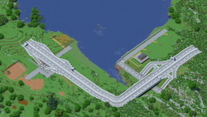
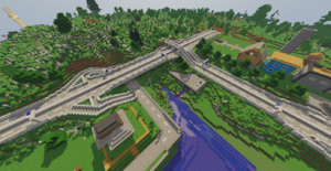
The most iconic building of the town is the two large freeways that span over the town, edge to edge.
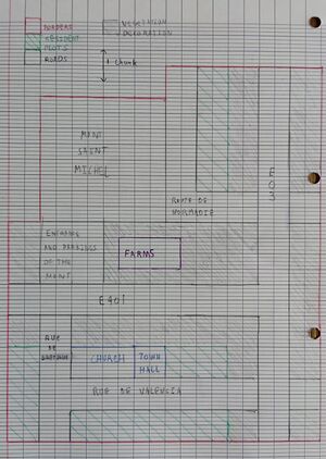
They are inspired from real-life freeways, the E402 and E03.
Those freeways are connected to a smaller road system through interchanges. The smaller roads then connect houses and other elements of the town.
Mont Saint Michel
Currently under construction, the Mont Saint Michel is a very famous location in real life. The construction is excepted to be done in summer of 2022.
Porte de Bretagne
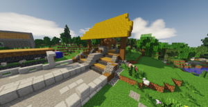
This gate marks the limit between Saint-Malo and Breizh, and also transitions from the freeway to a smaller grass path road.
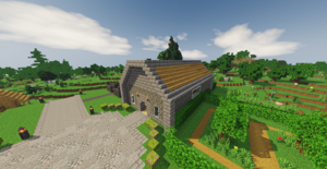
The Church
A simple church built in front of the town spawn, the Place Nationale.
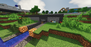
Villager Farm
A villager farm built right by the sea, with a water canal going through to allow villager exchange. It is composed of a breeding room with three beds colored like the Netherlands' flag, and a hub room with trading villagers, and stock villagers for sale.
